US Patent Nr: US2393676 A, Inventor: Fuller Richard Buckminster
US Patent Nr: US2393676 A, Inventor: Fuller Richard Buckminster
US Patent Nr: US2393676 A, Inventor: Fuller Richard Buckminster
US Patent Nr: US2393676 A, Inventor: Fuller Richard Buckminster
US Patent Nr: US2393676 A, Inventor: Fuller Richard Buckminster
Jan. 29, 1946. R, B FUL ER 2,393,676
US Patent Nr: US2393676 A
Inventor: Fuller Richard Buckminster
Application February 25, 1944, Serial No. 523,842 3 Claims. (01. 35-46)
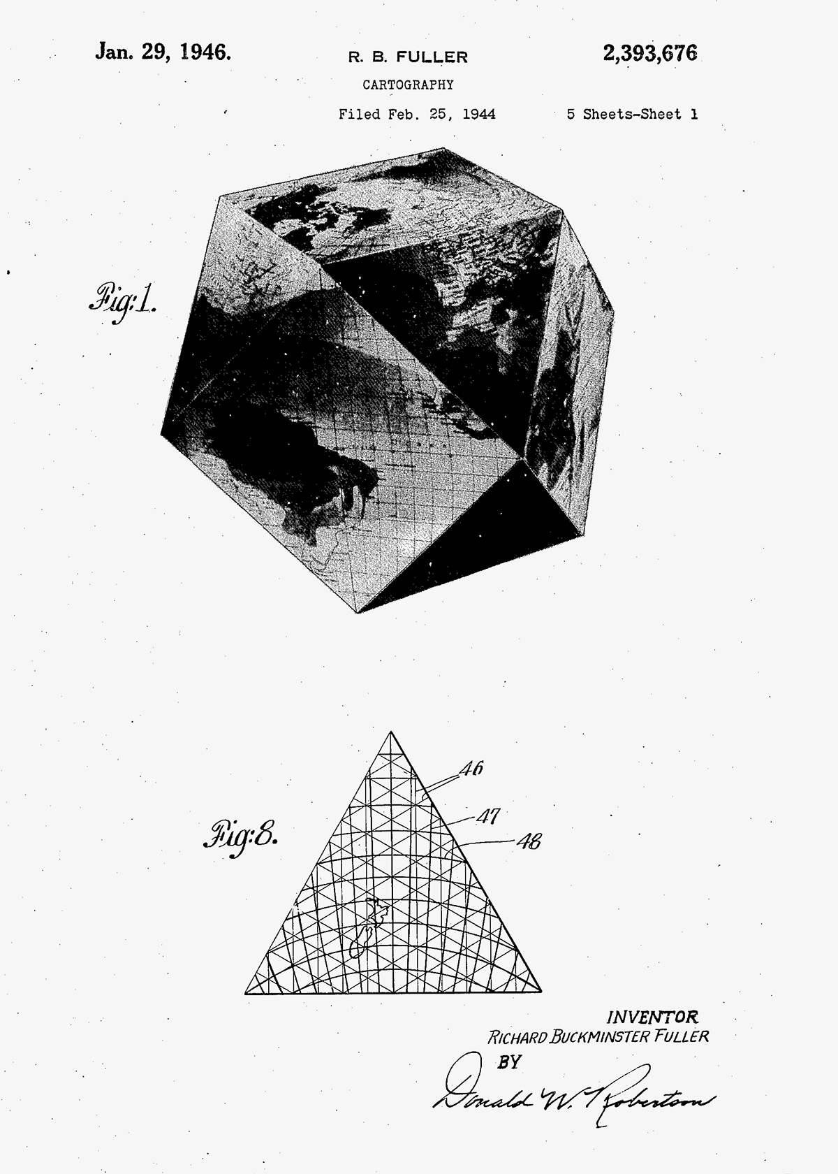
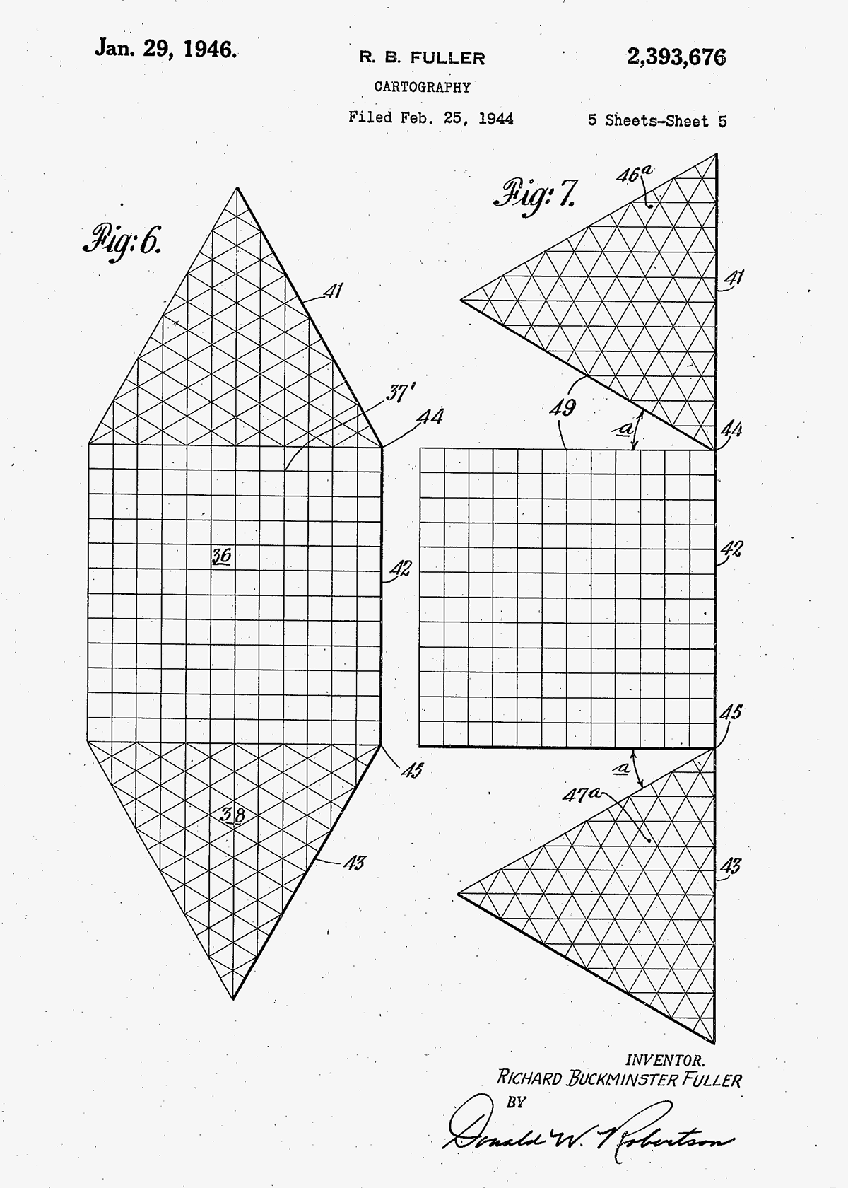
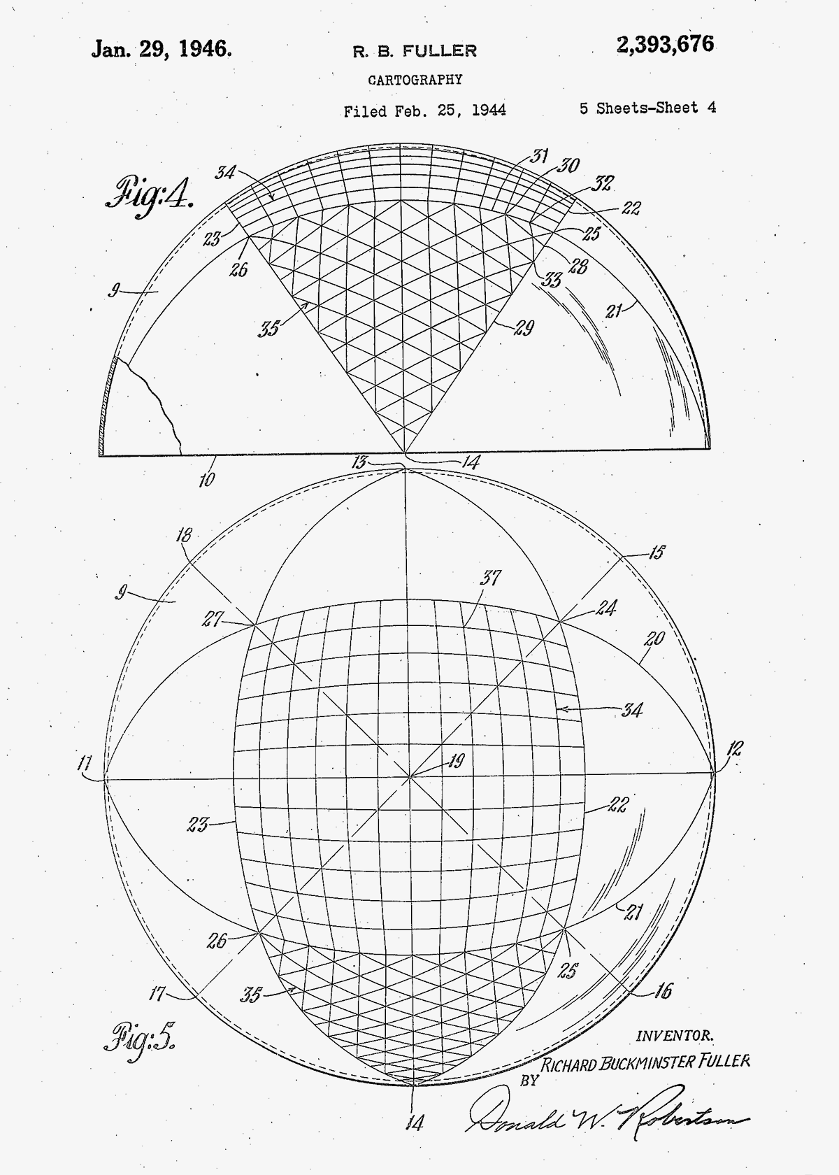
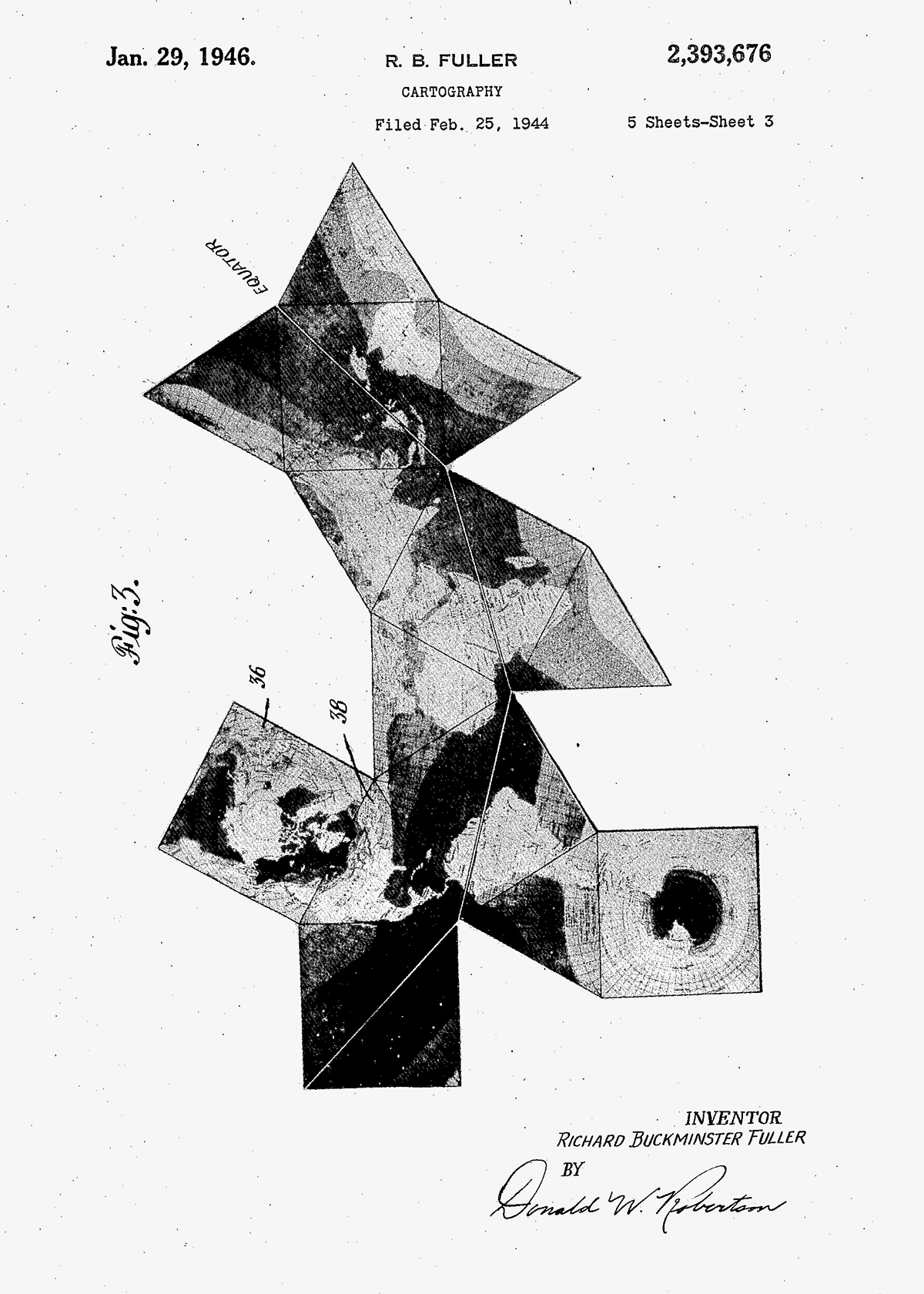
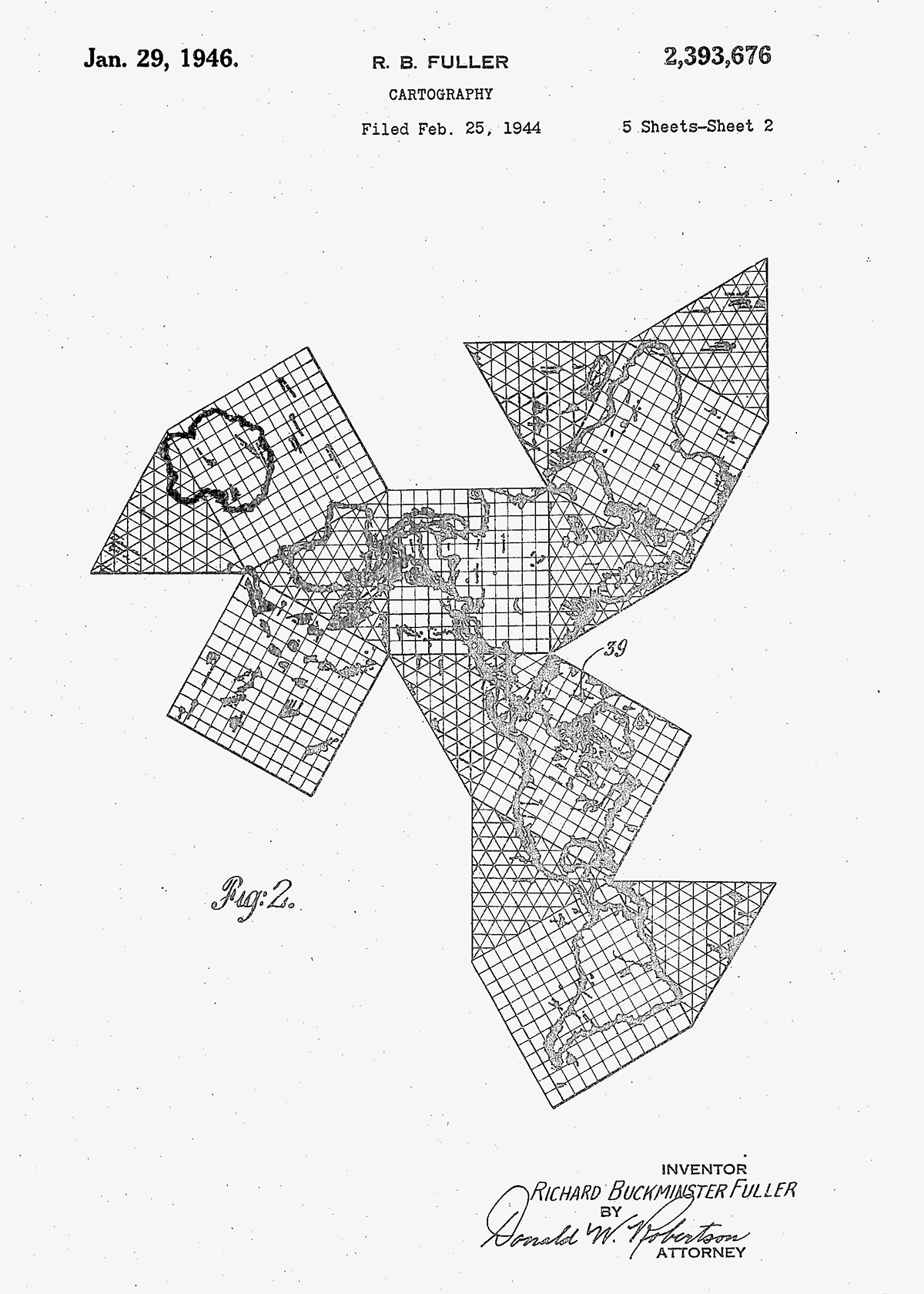
The invention relates to cartography
As the earth is a spherical body, so the only true cartographic representation of its surface must be spherical. All flat surface maps are compromises with truth. For example, Mercators projection is true to scale only along the equator, and azimuthal projection is limited to convergence of the meridians at one pole at a time. Other known systems of projection can be made to give uniform scale along parallels, or to give equal areas albeit with exaggerated shape distortions.
Another expedient has been to resolve the earths surface into a polyhedron, projecting gnomonically to the facets of the polyhedron, the idea being that the sections of the polyhedron can be assembled on a flat surface to give a truer picture of the earths surface and of directions and distances. Such a system is fettered to the limitations and gross radial distortions which characterize gnomonic projection.
It is an object of my invention to provide a sectional map of the world, or of a portion of its surface, Which is so constructed that its parts can be assembled to give a truer over-all picture of areas, boundaries, directions and distances than is attainable with any type of plane surface map heretofore known.
Another object has been to provide a subdivision of the earths surface for cartographic purposes which will result in sections that can be assembled with fewer sinuses in land areas than is possible with sectional maps heretofore known.
Another object has been to provide a subdivision of the earths surface for cartographic purposes which will result in sections that can be assembled with fewer sinuses in land areas than is possible with sectional maps heretofore known.
Full patent description under:
google.com/patents/US2393676?dq=2393676&hl=de&sa=X&ved=0ahUKEwih07_r_d7UAhUlCMAKHYR0A-YQ6AEIKTAA
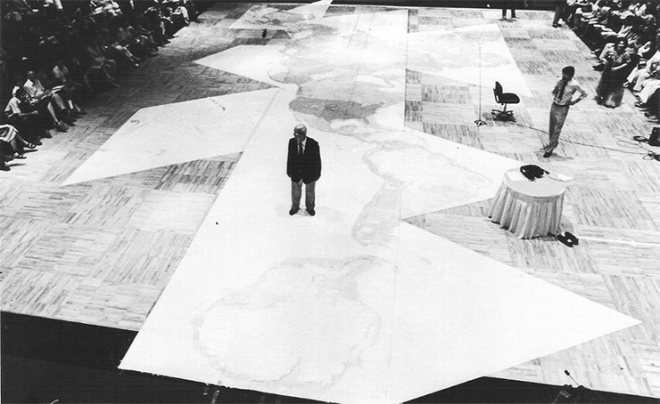
Buckminster Fuller standing on the "Big Map", used by the World Game Institute in the 1980s and 90s.
Source: genekeyes.com/FULLER/BF-6-later-ed.html Links:
Buckminster Fuller Institute: www.bfi.org
Evolution of the Dymaxion Map: genekeyes.com/B.J.S._CAHILL_RESOURCE.html
Dymaxion: de.wikipedia.org/wiki/Dymaxion